
Accident Reconstruction
How 3D Laser Scanning Supports Accident Reconstruction
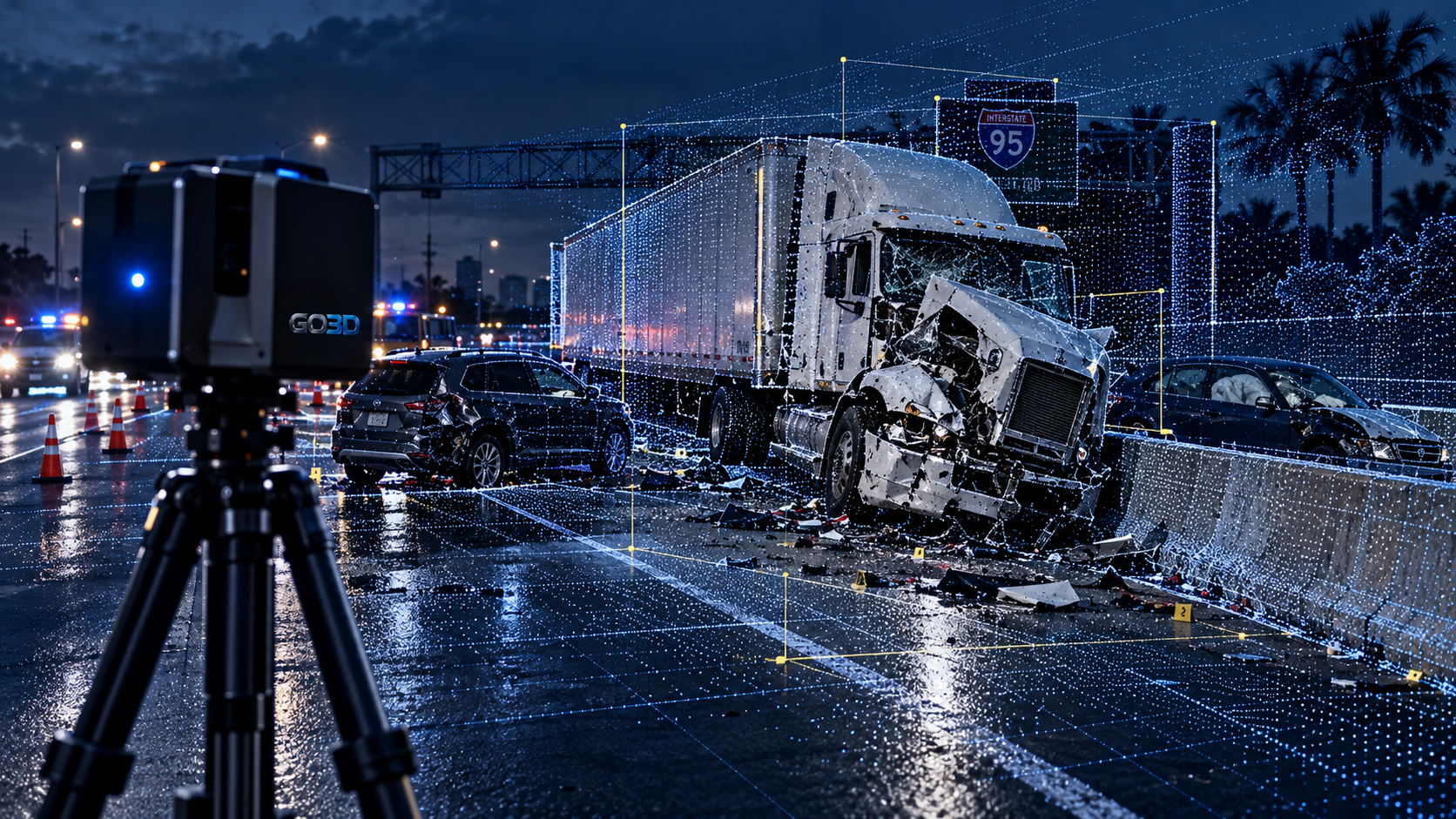
A crash scene begins changing almost as soon as traffic stops.
Emergency crews move vehicles. Tow operators clear damaged cars. Debris gets removed. Rain can wash away tire marks, fluids and small evidence. Road crews reopen lanes because leaving a highway closed creates another safety problem.
That gives investigators and retained reconstruction professionals a limited window to document physical conditions.
Accident reconstruction depends on more than photographs of damaged vehicles. The technical team may need roadway geometry, vehicle positions, surface evidence, grades, slopes, barriers, sight lines, impact areas and the final resting locations of vehicles.
3D laser scanning provides a way to preserve that geometry in a measurable digital record.
The scanner does not decide what happened. It records physical conditions so the professionals responsible for the reconstruction have better data to work from.
Accident Reconstruction Starts With the Scene Record
A reconstruction expert needs reliable information about the crash before forming an opinion.
The National Highway Traffic Safety Administration follows the same basic principle in its crash research programs. NHTSA's Crash Investigation Sampling System sends trained crash technicians to document evidence such as skid marks, fluid spills, struck objects and vehicle damage.
NHTSA's Special Crash Investigations program goes deeper. Its investigators document skid and yaw marks, possible impact areas, final rest positions, vehicle damage and other scene evidence. Event Data Recorder information may also become part of the case when it is available.
Those sources serve different purposes.
A roadway photograph shows appearance.
A police report records observations and reported facts.
An Event Data Recorder may contain specific vehicle data.
A 3D scan preserves measurable geometry.
A reconstruction professional may need several of those sources together.
GO3D's job is to capture and organize the spatial record. The retained reconstruction expert decides how that information fits into the larger analysis.
What 3D Laser Scanning Captures at a Crash Scene
A terrestrial laser scanner records distances to visible surfaces from one or more scanner positions.
Those measurements create a point cloud. Each point represents a measured location in three-dimensional space.
When several scan positions are registered together, the result can preserve a large portion of the physical scene.
Depending on access, visibility and project requirements, the captured data may include:
- roadway edges and lane geometry
- medians and shoulders
- curbs
- guardrails
- barriers
- signs
- utility poles
- buildings
- bridge structures
- trees and fixed objects
- damaged vehicles
- debris fields
- tire marks
- gouges and pavement damage
- final vehicle positions
- property impacts
- surrounding terrain
- intersections
- ramps
- sight-line obstructions
The scanner records visible surfaces. It does not see through vehicles, walls or other objects.
That means scan planning matters.
The technician may need several scanner positions to reduce blind areas and capture the scene from different directions.
A good field plan focuses on the information the receiving technical team needs. Collecting huge amounts of data without a clear purpose does not improve a reconstruction.
Why the Point Cloud Matters After the Road Reopens
A serious crash can shut down a roadway for hours, but the scene cannot remain untouched forever.
Vehicles eventually leave.
Debris gets removed.
Traffic returns.
Damaged barriers get repaired.
Road construction may alter the site.
Months later, the physical scene may look different from the conditions that existed on the day of the crash.
A registered point cloud gives the technical team a digital spatial reference after those changes occur.
That record may allow a reconstruction professional to review distances between physical features, roadway geometry, vehicle positions and other measurable relationships without returning to an unchanged scene.
This is one reason NIST has studied terrestrial laser scanners for forensic practice. NIST notes that these systems are used to digitize accident and crime scenes and can support measurements involving vehicle dimensions, object locations and distances between fixed points.
The value is not the appearance of the point cloud.
The value is the measurable geometry it preserves.
Vehicle Documentation Is Part of the Record
The roadway is only part of many reconstruction projects.
Vehicle damage may also require detailed documentation.
A damaged vehicle may be stored at a tow yard, salvage facility, repair shop or other location. Access may be temporary.
The vehicle may later be repaired, sold, dismantled or destroyed.
3D capture can preserve visible exterior geometry while access is available.
Depending on the project, this may include:
- front-end deformation
- side damage
- rear damage
- roof deformation
- wheel positions
- damaged panels
- structural areas visible during inspection
- vehicle dimensions
- displaced components
- contact areas
- relationships between damaged surfaces
The captured geometry may support measurements and models for the retained reconstruction team.
Recent SAE research continues to examine 3D methods for pre-collision and post-collision vehicle documentation. A 2026 technical paper compared point-cloud data from two different capture systems across seven vehicles documented before and after impact, producing 14 vehicle datasets.
That study does not mean every scanner or scanning method has the same accuracy.
It shows why vehicle documentation has become an active area of technical research.
Equipment, setup, surface properties, distance, environmental conditions and processing methods all affect the resulting data.
A Scan Is One Data Source, Not the Reconstruction
A point cloud can preserve a large amount of physical information.
It still does not explain the crash by itself.
Accident reconstruction may involve other evidence such as:
- police reports
- photographs
- video
- witness statements
- vehicle inspections
- Event Data Recorder information
- roadway evidence
- vehicle specifications
- damage measurements
- friction information
- traffic-signal information
- medical or injury information when relevant to the retained expert's assignment
NHTSA's own Event Data Recorder research makes this point clearly. EDR information can provide useful real-world crash data, but NHTSA states that it should be considered with other data sources.
The same principle applies to 3D scanning.
Spatial data gives the reconstruction professional another technical record to evaluate.
GO3D does not take a scan and declare who caused the crash.
We provide measurable data to the professionals responsible for that analysis.
Roadway Geometry Can Affect the Technical Review
Roads are rarely flat, empty rectangles.
A reconstruction may involve:
- curves
- grades
- banking
- changing lane widths
- medians
- shoulders
- ramps
- barriers
- drainage features
- bridge structures
- roadside objects
- signs
- vegetation
- buildings
- changes in elevation
A scanner can capture visible geometry across these features when the field conditions allow it.
That becomes useful when the retained expert needs to evaluate spatial relationships.
A line-of-sight review is one example.
The location of a vehicle, sign, building, barrier or vegetation can affect what a driver might have been able to see from a particular position.
GO3D can provide the measured scene geometry.
The reconstruction expert decides whether and how that geometry relates to visibility, perception, reaction or crash causation.
Complex Crashes Need More Than One View
Some scenes are difficult to document from the ground alone.
Large commercial vehicle crashes may cover long distances.
Multi-vehicle incidents may involve debris across several lanes.
Bridge crashes can include geometry above and below the roadway.
Construction zones add barriers, equipment, temporary lane configurations and changing site conditions.
A reconstruction project may combine several forms of spatial documentation.
Ground-based laser scanning can capture detailed local geometry.
Aerial imagery or other approved data sources may provide broader site context.
SAE researchers have studied workflows that combine LiDAR, aerial imagery and photogrammetry when accident sites have changed or are difficult to access.
One 2019 SAE study evaluated a method that combined historical USGS LiDAR, aerial imagery and scene photographs to reconstruct three accident locations. The study compared evidence locations against measurements from total-station surveying and ground-based 3D scanning.
That research involved a specific method and dataset. It should not be treated as a universal accuracy claim for every project.
It does show why reconstruction professionals increasingly work with several types of spatial information.
Commercial Vehicle Crashes Add More Geometry
A tractor-trailer crash can create a large and complicated scene.
The tractor and trailer may rest in different orientations.
Cargo can move or spill.
Barriers may be damaged.
Multiple passenger vehicles may be involved.
Debris can extend across a large section of roadway.
The physical size of the vehicles also creates more surfaces and more potential obstructions during scanning.
Planning matters.
The technician needs to consider where scanners can be positioned safely and what parts of the scene need the greatest detail.
The same applies to buses, delivery vehicles, work trucks and other commercial equipment.
GO3D can document the visible scene and vehicle geometry that falls within the project scope.
We then organize the data for the retained technical team.
Motorcycle, Pedestrian and Intersection Cases Need Careful Scene Capture
Not every reconstruction involves two passenger cars.
Motorcycle collisions may include a long evidence path and relatively small physical objects.
Pedestrian incidents may require careful documentation of roadway geometry, crosswalks, signals, curbs, lighting locations and surrounding features.
Intersection crashes can involve several travel paths and complex lane geometry.
The scanning plan should reflect the scene.
A small object that matters to the case needs enough capture detail to be useful.
A broad intersection needs enough scanner positions to preserve the surrounding geometry.
The equipment is only one part of the job.
Field decisions determine what data the technical team receives later.
What GO3D Can Deliver to the Retained Team
Raw scanner files are not always the most useful final product for every client.
The receiving team may work in CAD software, point-cloud software, modeling platforms or visualization tools.
Before field work begins, it helps to define what the technical team needs at the end.
Possible deliverables may include:
- registered point clouds
- cleaned point-cloud datasets
- measurable 3D scene models
- vehicle surface models
- mesh geometry
- CAD reference geometry
- 2D scene diagrams
- plan views
- elevations
- cross sections
- still images from selected viewpoints
- visualization assets
- technical data packages
- organized source files
The correct deliverable depends on the project.
An attorney may need clear visual material for case preparation.
An engineer may need measurable geometry.
A reconstruction professional may want the registered point cloud and vehicle data.
A visualization specialist may need models prepared for another workflow.
GO3D defines that handoff with the client before producing unnecessary files.
Accuracy Depends on More Than the Scanner Specification
A manufacturer may publish accuracy specifications for a scanner.
Those numbers do not describe every field condition.
Real-world performance depends on several factors:
- scanner calibration
- scan distance
- angle of incidence
- surface reflectivity
- environmental conditions
- scanner placement
- registration quality
- movement within the scene
- operator technique
- processing choices
NIST has developed procedures focused on performance evaluation and measurement traceability for terrestrial laser scanners in forensic practice.
That matters because technical data needs more than visual appeal.
A point cloud that looks impressive on a screen still needs sound field practices and quality control.
GO3D treats the scan as technical data first.
Scene Access and Safety Shape the Capture Plan
Crash scenes create practical limits.
Traffic may still be moving nearby.
Emergency personnel need room to work.
Tow operators may need access to vehicles.
Weather may be changing.
The roadway may need to reopen quickly.
The scanning plan has to fit those conditions.
More scan positions are not always better if they interfere with scene operations or add data without a technical reason.
The goal is to document the required geometry safely and efficiently within the available access window.
This is another reason early communication helps.
If the retained team already knows it needs a specific roadway feature, vehicle surface or measurement area, GO3D can account for that before field capture begins.
Call Before the Scene or Vehicle Changes
The best time to discuss 3D documentation is before access disappears.
That may mean contacting GO3D while the roadway is still controlled.
It may mean scheduling vehicle scanning at a tow yard before a vehicle leaves.
It may mean documenting a damaged structure before repairs begin.
You do not need to know every final deliverable before making the call.
You should know what physical conditions may disappear.
GO3D can discuss the scene, access window, available equipment, capture requirements and intended handoff with your team.
GO3D's Role in Accident Reconstruction Support
GO3D is the spatial-data specialist.
We capture real-world geometry.
We document scenes and vehicles.
We process point clouds and models.
We prepare technical files for the people responsible for reconstruction, engineering, investigation and legal strategy.
The retained reconstruction professional remains responsible for the reconstruction analysis and conclusions.
That separation keeps the role clear.
Your expert gets measurable spatial information.
GO3D focuses on collecting and preparing it.
Discuss an Accident Reconstruction Project
If your case requires measurable crash-scene or vehicle documentation, contact GO3D before the physical conditions change. We can discuss access, capture requirements and the technical files your retained team needs.
CONTACT GO3DFREQUENTLY ASKED QUESTIONS
What can 3D laser scanning document at an accident scene?
3D laser scanning can record visible roadway geometry, damaged vehicles, barriers, curbs, signs, debris areas, fixed objects and other physical surfaces within the scanner's line of sight. The exact capture scope depends on the scene and the needs of the retained technical team.
Can measurements be taken after the crash scene has been cleared?
A registered point cloud preserves measurable spatial relationships from the captured scene. Qualified professionals can review that data after vehicles and debris have been removed, provided the required geometry was captured during the original field work.
Does GO3D perform the accident reconstruction?
GO3D provides reality capture, measurements, point clouds, models and technical spatial data. Retained accident reconstruction professionals interpret the evidence and reach reconstruction conclusions.
Can GO3D scan damaged vehicles at a tow yard or storage facility?
Yes. Vehicle documentation can take place separately from the roadway scene when access is available. The project scope determines which visible vehicle surfaces and damage areas need to be captured.
Does 3D scanning replace photographs or Event Data Recorder information?
No. These records provide different types of information. Photography records visual appearance. A point cloud preserves measurable geometry. Event Data Recorder information may provide vehicle data when available. Reconstruction professionals may review several evidence sources together.
SOURCES & REFERENCES
- National Highway Traffic Safety AdministrationCrash Investigation Sampling System
- National Highway Traffic Safety AdministrationSpecial Crash Investigations
- National Highway Traffic Safety AdministrationEvent Data Recorder
- National Institute of Standards and TechnologyTerrestrial Laser Scanner Performance Evaluation and Documentary Standard for Forensic Practice
- National Institute of JusticeTerrestrial LiDAR Scanners: Guidelines for Use in Criminal Justice Applications
- SAE InternationalReconstruction of 3D Accident Sites Using USGS LiDAR, Aerial Images, and Photogrammetry (SAE Technical Paper 2019-01-0423)
- SAE InternationalA Comparison between Leica RTC360 and Recon-3D Scan Data in Pre- and Post-Collision Vehicle Documentation (SAE Technical Paper 2026-01-5030)
RELATED SERVICES
RELATED TOPICS
- #AccidentReconstruction
- #3DLaserScanning
- #CrashSceneDocumentation
- #RealityCapture
- #VehicleDocumentation
- #PointCloud
- #ForensicTechnology