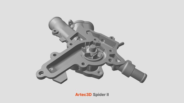
Artec Spider II
Artec 3D · CC BY 4.0
Water pump
8.15M trianglesOriginal download: 54.74 MB OBJArtec 3D · CC BY 4.0
Inspect industrial scans containing millions of triangles. Explore complete building and mobile-mapping collections. Keep source resolution, scanner context and reuse terms visible.
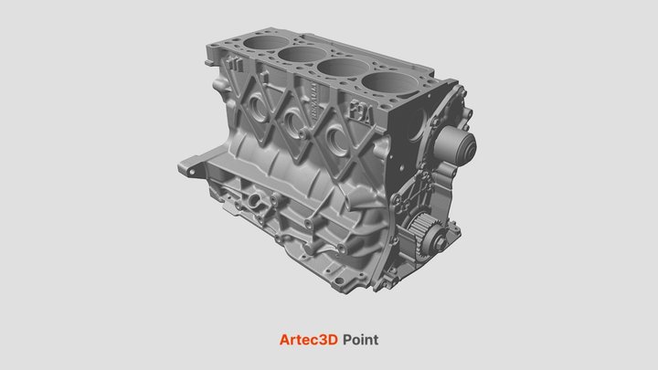
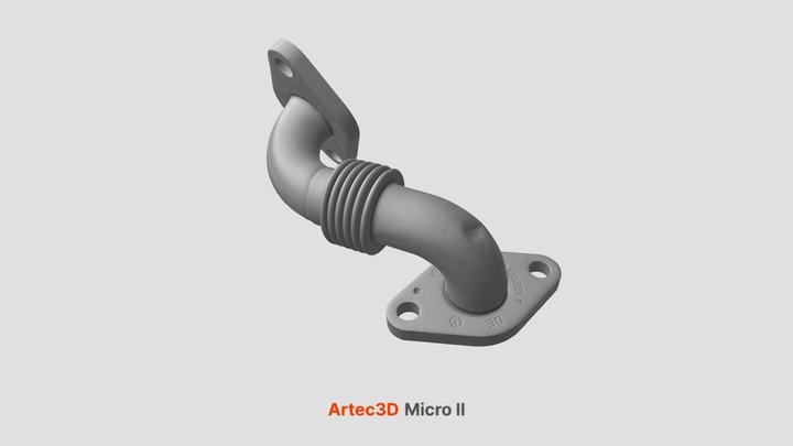
These are real third-party scanner examples, not GO3D work. Water pump, Four-cylinder engine, EGR connection pipe by Artec 3D, licensed CC BY 4.0. Geometry is presented through the creator’s published Sketchfab embeds; files remain with their source.
Millions of triangles. Real scanned surfaces.
Select an example to start its interactive viewer.
Full-resolution datasets stay with their publishers. Source-linked collections below include freely reusable data and provider-controlled research access, clearly distinguished by their terms.
Real shell-construction and renovation environments, including residential, office, educational and parking scenes. Coordinates, RGB, intensity, normals and annotations are supplied in modular downloads.
CC BY 4.0 · credited to Lukas Rauch and Thomas Braml. Download from the publisher; large dataset, select files.Explore the original collection ↗Indoor and outdoor campus capture from a Leica P50. Both full-resolution and subsampled point clouds are linked by the project.
Provider-hosted collection. Inspect its download terms and documented Z-offset before reuse or combining models.Explore the original collection ↗2024 building and surroundings capture with separate terrestrial and UAV point clouds, acquisition documentation and trajectory data.
Provider-hosted originals. Check the record’s license and acquisition documentation; files are not mirrored here.Explore the original collection ↗Facade-scale mobile mapping collections for exploring windows, doors, balconies, architectural detail and hierarchical facade understanding.
Separate datasets with provider-specific access and terms. Linked from the official project; not a GO3D acquisition.Explore the original collection ↗Dense airborne LiDAR and image-derived textured meshes, with multiple capture epochs and manually labeled classes.
Research benchmark. Registration and dataset terms apply; commercial redistribution has not been established here.Explore the original collection ↗Use the official explorer for topographic point clouds, quality levels, geographic selection and complete source tiles instead of a tiny overview sample.
USGS National Map data are generally public domain. Inspect individual metadata, datum and quality information.Explore the original collection ↗The original starter files remain below for quick format and browser checks. They are deliberately lightweight; use the professional examples above to explore richer capture data.
Move from a file extension to something you can see. Inspect open scan data, textured objects and CAD exchange files—then find the right workflow for your project.
Independent examples from their credited creators. They are not GO3D client scans or proof of survey accuracy.
Choose a card below. Files load only when you ask; no account or upload is needed.
No sample loaded. Drag to rotate; scroll or pinch to zoom.
Start small, compare formats, then inspect a richer file. Native LAS, LAZ and E57 downloads are paired with browser-friendly previews where needed.
No matching samples. Try a broader search or reset the filters.
Wide-area LiDAR helps with terrain, trees and built context. Coordinate systems, vertical datums and ground classification matter as much as point count.
Site documentation ↗Tripod and mobile laser workflows capture spaces and complex surfaces. Compare coverage and occlusion before assuming a scan is complete.
Capture & measurement ↗Depth cameras and handheld systems suit different object sizes and surface conditions. A single frame has missing surfaces; registration joins views.
Object-to-CAD workflows ↗Photogrammetry and textured models communicate appearance. A persuasive render is not proof that dimensions or material properties were measured.
Creative Studio ↗For scanner makes and workflows beyond this starter library, use the owners’ sample hubs. Downloads and reuse conditions are controlled by each provider; “free to download” does not automatically mean permission to redistribute.
CC0 and public-domain samples permit broad reuse. CC BY requires attribution; keep the supplied credits when sharing a derivative. CAD fixtures retain their stated license. Always inspect the original source and license before commercial reuse.
Preview PLYs may be thinned or centered for browser performance. A colour ramp may visualize elevation instead of camera RGB. These changes are recorded with each sample. E57, LAS and LAZ files are downloadable originals or explicitly described conversions; this browser does not directly decode every scanner format.